stir it up

We are on our last jar of jerk seasoning, and I’ve promised a friend a taste of the Caribbean. It has to be home made.

It’s handy when you’ve posted the recipe yourself! I check my blog in the greengrocer’s for the recipe, and pick up a batch of habañero and cassette chillis, just to mix things up.

Lemon thyme is on sale so I choose that over regular thyme.

img_8864

I’m not cooking with onion much these days so I pick up a bunch of Chinese leek flowers and some celery instead of the usual spring onions or scallions as we call them in Ireland.

img_8861

This is going to be the quickest batch ever, I tell myself. At home, I pull out the Allspice and nutmeg from the back of the cupboard and pulverise the little black peppers in my pestle and mortar.

img_8862

I get to chopping and soon I have the blender on the go.

I find some sage in the freezer and throw that in as well. Lemon thyme? Why not. We’re in Australia.

As usual, I use a mix of white vinegar and water to loosen things up when the blender struggles. I poke around with a chopstick in between times, and throw in a few spoonfuls of salt and brown sugar.

img_8865

The result is pretty pungent stuff, but even now I can smell the aromas mixing. It’s going to be a good batch, I hope.

Lastly, I squeeze a fresh lime into the mixture and stir it in. I like to leave the lime till last, as I find the blender changes the flavour.

That’ll sit in the fridge now for a day or so to settle, then I will pour into sterilised glass jars to keep for longer.

We’re in business!


east to west

The day starts soft, and I dodge the showers getting everything out to the car. My belongings seem to have expanded far beyond a single backpack: a shopping bag full of Irish teabags and birthday presents, a holdall with my footwear. The worry of shrinking back to one piece of luggage is a few days away yet, so I kiss my brother and sister-in-law and drive away – auspiciously, in the wrong direction.
Back on track with the satnav, I follow turf trucks, tractors and crazy tradesmen through the country roads of west Kildare towards the heart of the Bog of Allen. Bungalows gleam in the sunshine; gardens and hedgerows are ablaze with colours as the late summer brings out red fuchsia, orange montbretia, purple redshank and mauve hydrangea.


I drive along, close to Kildare’s border with Offaly, passing brown barns and raised bogs and nature reserves and hayfields and canals. 


I stop at Rathangan as the Angelus rings out. The Spencer Bridge at Lock 23 dates from 1784; sadly the lock here is no longer in use because of a nearby culvert collapse, but it’s beautiful nonetheless. I sit and take in the silence for a few minutes before driving on.

Past a busy Monasterevin, I hit the M7 and return to the twenty-first century. I speed past towns and villages whose names used to be milestones on my regular journeys between Dublin and Cork back in the late eighties: Urlingford, where I always stopped at Kavanagh’s petrol station for the best scones in the midlands; Twomileborris and Horse and Jockey; Mitchelstown, where the creamery was, and Fermoy where you knew you were firmly back in Cork. 

At Watergrasshill I get a fit of the nostalgics and come off the motorway early to find the cottage in Glanmire where I lived happily for two years. Up a winding country road in Eastcliff, here it is: Woodbrook, with the steepest driveway in the world, sitting alongside DJ Rockin’ Gerry’s house on the cliffs above the Glashaboy River.


Heading into Cork I get stuck in the wrong lane and end up circumnavigating the famous Bells of Shandon before escaping the city. Motorway soon turns into main road, then into country road as I turn left at Crookstown. I stop to top up my water bottle and find myself at a road sign pointing me to the “Ambush Site”. I’m in Béal na Bláth, where Irish patriot Michael Collins was shot dead in an ambush on 22 August 1922. I detour up a boreen and pay my respects at a high Celtic cross on the spot where he fell. A fitting thing to do on the centenary of the 1916 rebellion.

Béal na Bláth, Co. Cork

Over the Cousane Gap, the scenery gets more and more spectacular. I catch a glimpse of water and a blue “Wild Atlantic Way” signpost, and I know I am almost there. I check into my B&B and stroll downtown to the centre of Bantry town. The weekly market is just finished and Wolfe Tone Square is awash with Hiace vans, packing cases and half-deconstructed awnings. 


Down past the railway cottages at the pier, a Lottery-funded footpath provides spectacular views across Bantry Bay to Whiddy Island. The tide is almost out and the smell of the seaweed brings me back to childhoods in Galway. There’s heat in the evening sun, and I stop to peel off a few layers before turning back.

Bantry Bay
Later, in O’Connor’s restaurant, I feast on seafood chowder and a huge lump of monkfish, all local produce. The place doesn’t seem that busy but as I finish up round nine in the evening, quite a few people start steaming in. I’m tempted to find a friendly bar with some live music but the long drive has finished me off. 
locally caught roasted monkfish and Asian noodles in O’Connor’s of Bantry

Even though it’s close to ten at night it’s still broad daylight as I tuck myself up in my little single bed with a glass of red and a handful of Oatfield Emeralds to watch the best of the Late Late Show.

the south rim

The Las Vegas lifestyle does not lend itself easily to a 5am wake-up call. Getting to bed at 5am is more the plan. Yet we find ourselves standing under a palm tree well before six in the morning waiting for our tour bus. Orlando is reeled in by an extraordinarily chatty young woman in red tracksuit pants who manages to reveal quite a bit about her life before we are saved.

IMG_1572

By seven we have bright orange tour wristbands on, sausage and egg muffins in hand and a large coffee on the go as we settle into our chariot for the day. Richard Gere is the name of our driver (he says). He is shorter and a lot more Pacific-Islander-looking than he appears in the movies.
We are headed for the south rim of the Grand Canyon, to the heart of the Grand Canyon National Park. It is five hours there and five hours back, but my research tells me it’s by far the best view of the Grand Canyon compared to the so-called “west rim” which is an attraction manufactured by the local Hualapai tribe to offer a shorter day trip for Vegas tourists. The Grand Canyon itself is about 277 miles long; the “west rim” attraction (including the heavily-advertised Skywalk) is at mile 260.
We drive out of Vegas past the homes of the rich and famous; our driver points out the homes of Barbra Streisand, Tom Selleck and others on the outskirts of a Boulder City as we head for our first stop at the Hoover Dam. It’s a brief stop and the engineer in me wishes I’d driven up here myself; sure, we get a pretty good photo opportunity, but we stop nowhere close to the dam itself and I would have liked to walk it and take it in a little more slowly. But I’m happy with the viewpoint and we drive on.
IMG_1589
A couple of hours later we have another break in Seligman, a small rundown village on a section of the now decommissioned Route 66. A few friendly cafés and gift shops are cashing in on the Route 66 obsession, with all kinds of memorabilia, tee shirts, fridge magnets and so on, sweetened by the offer of free coffee and restrooms. It’s kitsch but doesn’t take itself too seriously, and all the shops proudly advertise that they sell only products made in the USA. I like it.
IMG_1623
IMG_1634
Back on the bus we settle down to watch a movie as the landscape continues to change. We are deep in the Mojave Desert here, with endless miles of rocky treeless hills. It’s beautiful. Close to noon we see a thunder storm in the distance; the driver tells us that is the beginning of the Grand Canyon.
IMG_1615
Five long hours after leaving Vegas, a handful of us are deposited at the Grand Canyon airport for our helicopter flight. I’d always promised myself that if I made it to this part of the world I’d do it properly, so we forked out the extra US$200 a head  for the aerial view. At check-in we are weighed and our small daybags are taken and locked away: we’re allowed nothing on board except a camera. Flotation devices are strapped to our waists (what are the chances??) and we are led through a safety briefing video by the charming JR, an elderly tribesman with a twinkle in his eye who clearly loves his job.
Minutes later we are standing by a tiny helicopter and I remember with alarm that I have a touch of vertigo. Heights I am pretty ok with; descending from any height, including a steep flight of stairs at a train station, I get very nervous. Was this really a good idea? My nerves are confused by the honour/horror of being shown to the front seat by the pilot; Orlando goes in the back with three others. The floor of the cockpit under my footrest is glass. I’m going to have to do this.
IMG_1648
Tony, our pilot, welcomes us on board and we take off gently above the ponderosa forest. I’m doing ok so far. Soft rain begins to fall as “Riders on the Storm” plays through our headsets. Three or four minutes along we are cruising above the trees and I’m getting the hang of this heights thing.
IMG_1680
Tony points east and the music changes for the big reveal: the theme from 2001 A Space Odyssey plays as we approach the southern rim of the canyon. No words can describe the next few moments as the enormity and majesty of the canyon is revealed through dappled sunlight and misty rain. The music is exactly appropriate. It’s an extraordinarily emotional moment for me, and tears well up in my eyes. Spectacular.
IMG_1664
For twenty minutes we do a clockwise circuit across to the north rim and back, towards Dragon Head and then back past Isis Temple and Hermit Rapids. The North rim is about a thousand feet higher than the south rim, and the difference in vegetation is marked. The canyon spreads out as far as the eye can see in both directions, towering peaks vying with impossible vertical drops for our attention, glimpses of the river itself always tantalisingly fleeting. Layer upon layer of reds and browns, mixed with patches of misty rain, make the views even more atmospheric. Tony tells us that although the river looks small, it is around 300 feet (91 metres) wide as it winds through the canyon. At its deepest, its depth is around 85 feet (26 metres). Makes the flotation devices a little more sensible, then.
IMG_1672
All too soon we are back over the forest and heading back. We can still see glimpses of the canyon behind us as we retrace our flight path, hiding below ground level like a divine vision waiting to be fully revealed. I reflect that my Dad always wanted to see the Grand Canyon, and I am grateful to have been able to do the trip on his behalf.
IMG_1687
IMG_1721
Back on the ground, we are picked up and taken to two different viewing points within the national park. After our helicopter ride, we feel able to take our time and take it all in at a much more relaxed pace than our fellow travellers, but I still try in vain to take one or two photos that will go some way to showing the extraordinary beauty of this place.
IMG_1755
The rain persists but the beauty of the place is not for a moment dimmed. The lodgings in the National Park look like a fantastic place to spend a couple of days. I imagine waking up in the morning and watching the canyon all day as the light ebbs and flows and the colours change from moment to moment. We meet a small family group who have just completed a hike from the rim to the river and back: it’s taken them around nine hours in total. I’m kind of glad we took the lazy option.
IMG_1728
It’s past eleven at night when we are deposited back on the Strip in Vegas, almost eighteen hours after pick-up. We’ve spent more than half that time in a coach driving through the desert, but we will look back on this day as one of the highlights of our US trip. If you can manage a trip to the Grand Canyon, try to spend at least one night at the south rim in the National Park lodgings; if this isn’t possible just bite the bullet and do the long trip to the south rim. This might be the only time you ever get to see this natural wonder, so you might as well see it from the best vantage point.
IMG_1774

venice to santa monica

As I’ve confessed in the past, my hobby is walking on very long beaches. So when we got to LA one of my first priorities was to head to the sea. Technically Melbourne sits on Port Philip Bay, which is off Bass Strait, which is off the Southern Ocean, so a glimpse of the Pacific was high on the list.

We turn the Mustang south for a couple of miles until we pick up Venice Boulevard. Even in morning traffic it takes much less than an hour before we turn into the car park right on the edge of the beach.

IMG_0784

Orlando wants to stroll down the boardwalk but he knows I am impatient to get to the water’s edge. We kick off our shoes and walk through a hundred yards or so of sand. It’s a hazy morning and the surf is not huge, but I paddle in through the waves wishing for a moment that I’d brought my swimsuit.

IMG_0781

A stop for brunch, LA-style. The Venice Ale House does organic brunch which means that alongside the “free-range eggs your way” and bacon with everything there is chia pudding, a vegan scramble and valerian omelette. Their waffles are multigrain or gluten free, and they only serve a specific brand of water described as “powerful, hydrating, alkalinised and micro-structured.” Well, I am certainly glad it is micro-structured, otherwise all I’d they would give you is a messy pile of disassociated hydrogen and oxygen atoms in a glass, and nobody wants that. I opt for the kombucha instead.

IMG_0796

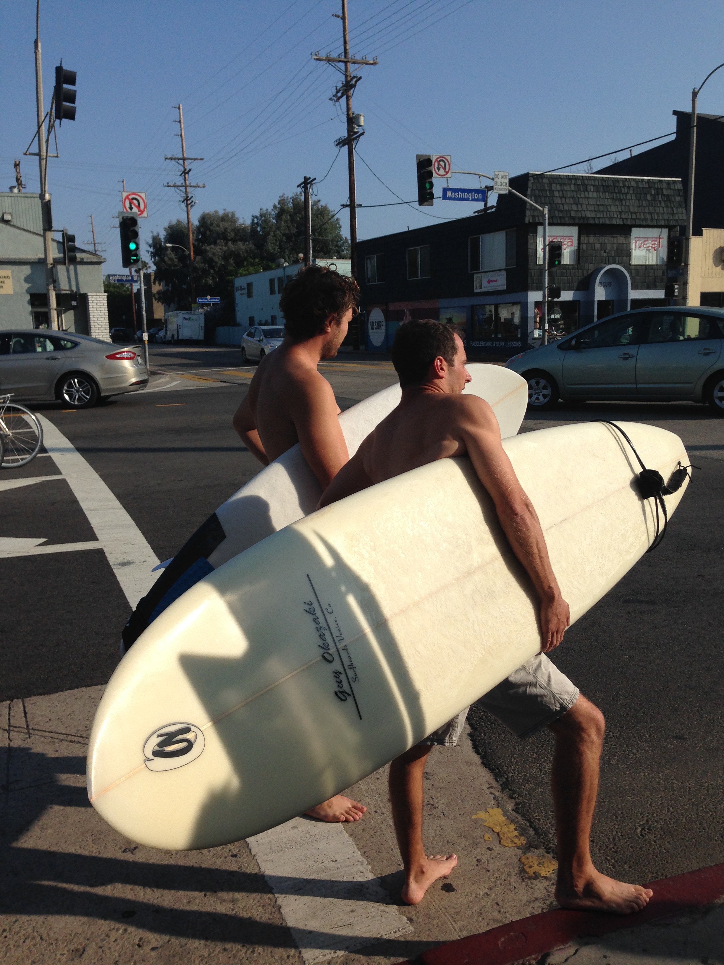
It’s a three-mile walk to Santa Monica Pier, shimmering in the distance through the morning haze. We stroll along Venice Boardwalk, glancing at the street vendor art stalls and dodging tourists getting the hang of their two-wheel driftboards. The bloke outside the Venice Beach Freakshow tempts his customers inside: “Hey girls, have you see our two-headed turtle? He’s right here!”

An old man with a hat and a guitar gives the memory of BB King a run for its money; moments later a young man with an adoring girlfriend and a guitar makes me want to give him “$ for gas” just to stop him playing. But then we see Harry Perry and our lives are complete: this white-clad turbaned dude is a living legend who’s been playing electric guitar whilst roller-skating up and down the boardwalk since 1973.

IMG_3879

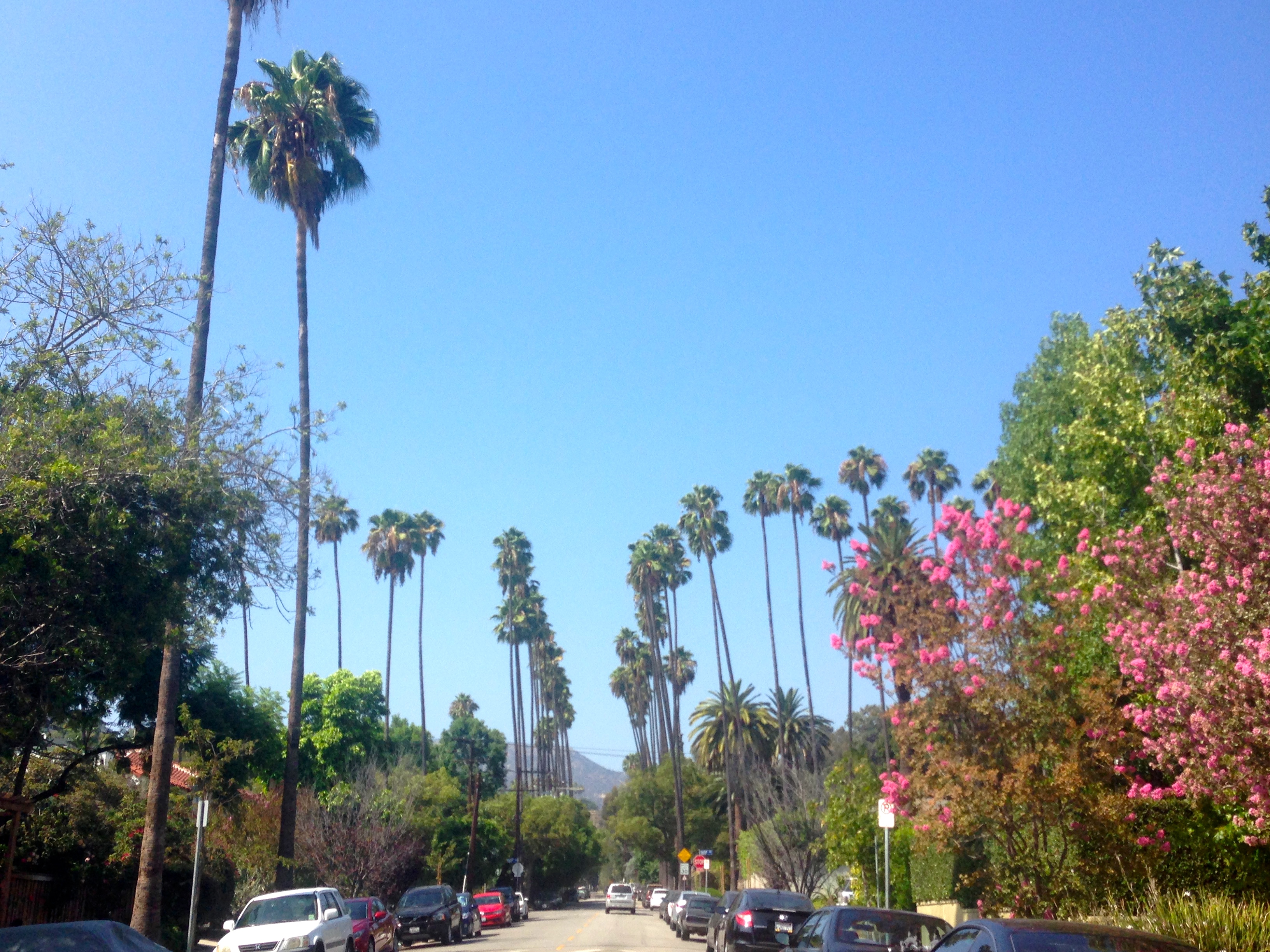
The row of stalls, bars and medical marijuana shops stops abruptly and the nice apartment blocks start. We are thrust onto the more residential setting of a palm-tree-lined footpath curving alongside the beach.

IMG_0806

Families cart boxes, bags and beach umbrellas through the sand to their favourite weekend spot; sunburnt tourists roll along on their fancy resort bikes alongside tandem riders and skateboarders. Two women navigate their elderly mother onto the sand on a beach wheelchair. It’s the first one I’ve ever seen but it won’t be the last today.

Santa Monica Pier is pretty busy on a Saturday afternoon. The shops sell the usual beach tat alongside a raft of Route 66 merchandise: Santa Monica Pier is where the legendary route ends in California.

IMG_0850

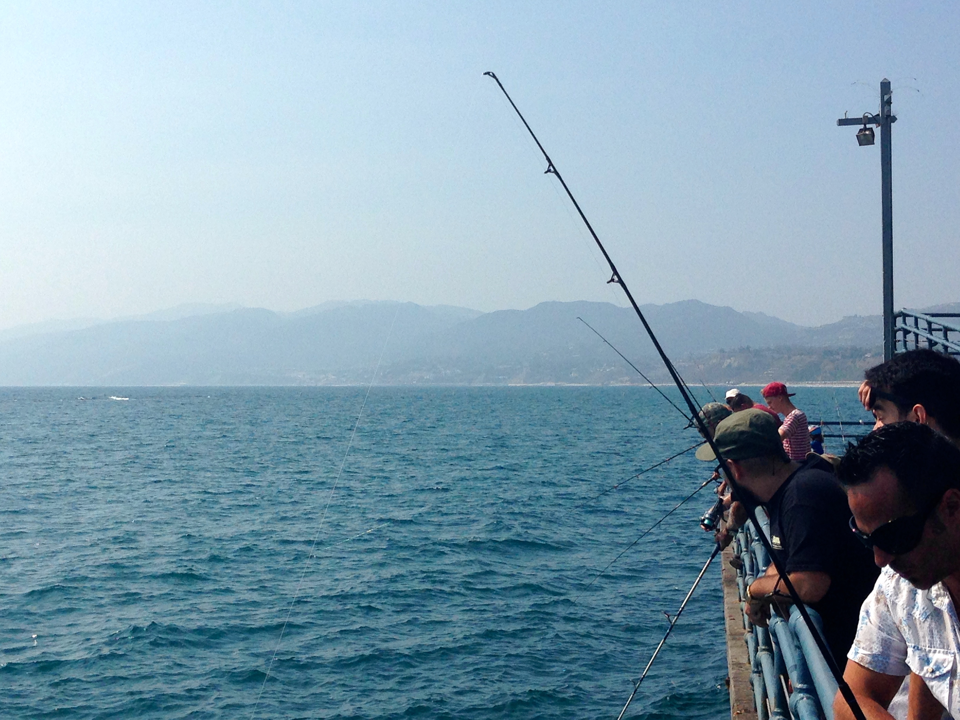
We wander through the Pacific Park fun fair right to the bottom of the pier where friends and families are fishing for halibut, herring, mackerel and sardines.

IMG_0832 IMG_0813

The wide sweep of the beach fans out behind us, the Santa Monica Mountains behind. It’s time to head back.

IMG_0821

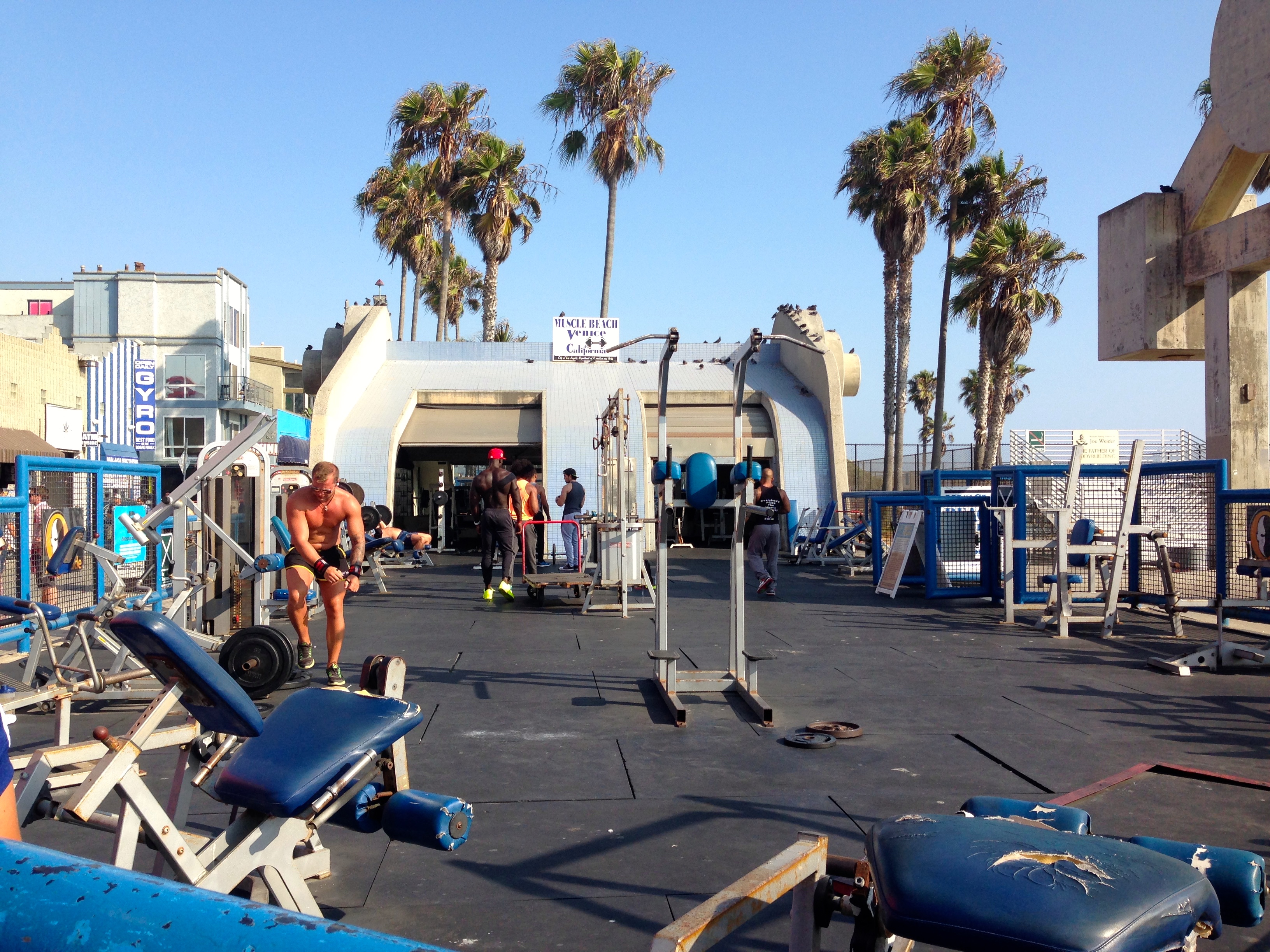
Back at the Venice end, the boys at Muscle Beach are still busy working out, although it’s not a busy as I thought it would be on a Saturday. Fangirls take selfies or ask for photos with the athletes. I’m not sure if any of them are actually famous or whether the girls just like their men extremely well sculpted.

IMG_0864 IMG_0867

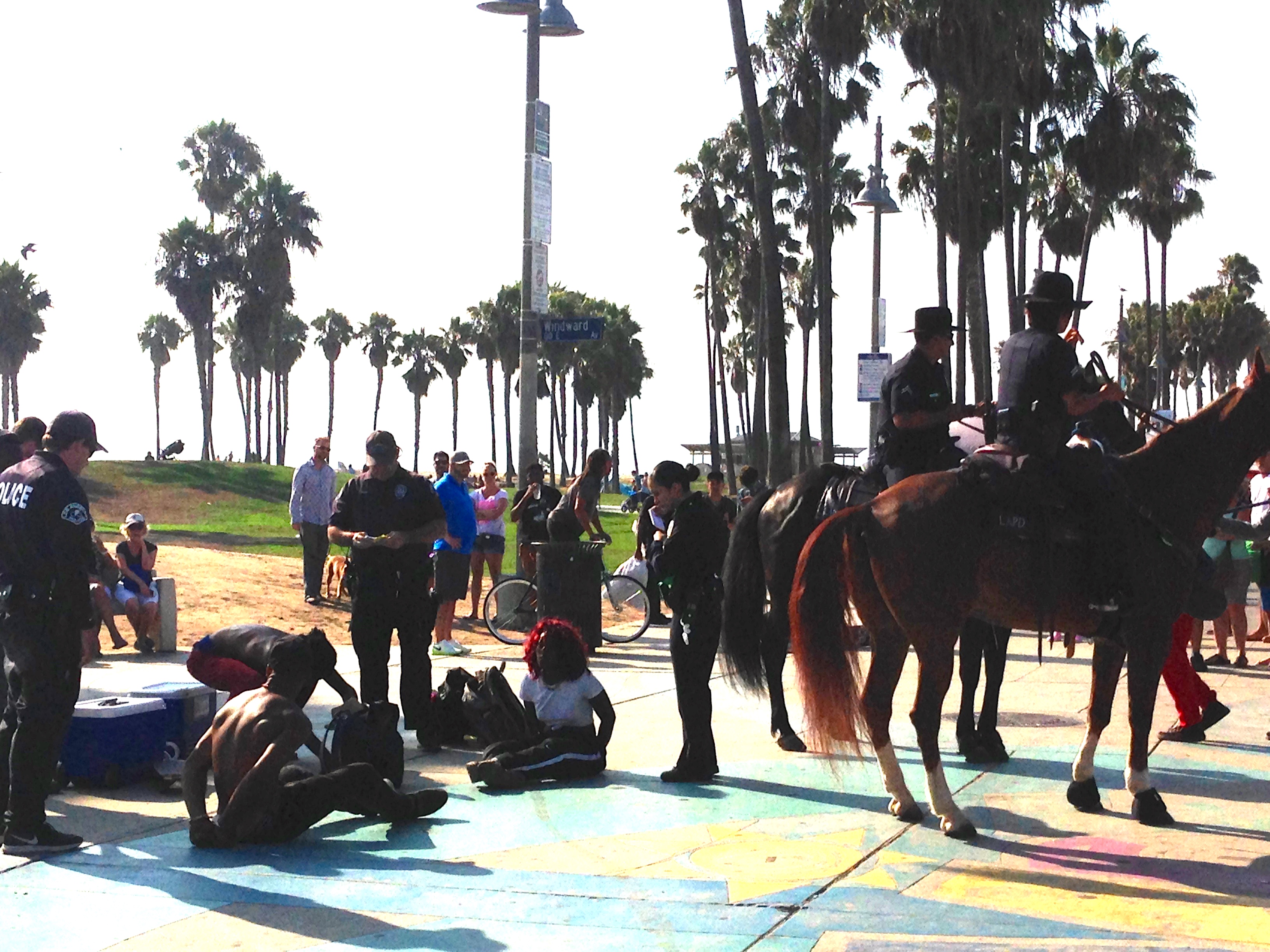
A small group of street performers near the skate park are being challenged by a couple of police officers. The performers look like young students, dressed in dance practice clothes. We’ve not seen the performance, nor can we understand what they are being arrested for, but they look a little bewildered and shocked rather than defiant or aggressive. The officers have already called for backup, it seems; within two or three minutes the original two officers are joined by another two on horseback and four more screaming to a halt in their cars.

IMG_0860

Some of the performers are made to sit on the ground with their hands cuffed behind them. Onlookers take photos and videos with their mobile phones, calling to the police officers to explain why they are being arrested. The performers themselves are being very compliant and quiet. There is now at least one police officer for every individual being detained, although only some appear to be getting arrested and cuffed. But just in case, a police helicopter appears overhead, adding to the noise and the drama. I suppose this is the USA and any of the performers might have had a firearm, but they just look like enthusiastic, earnest students keen to put on a street performance of something they’ve probably been rehearsing for weeks. I simply can’t fathom why this whole episode required the police presence and action I see unfolding.

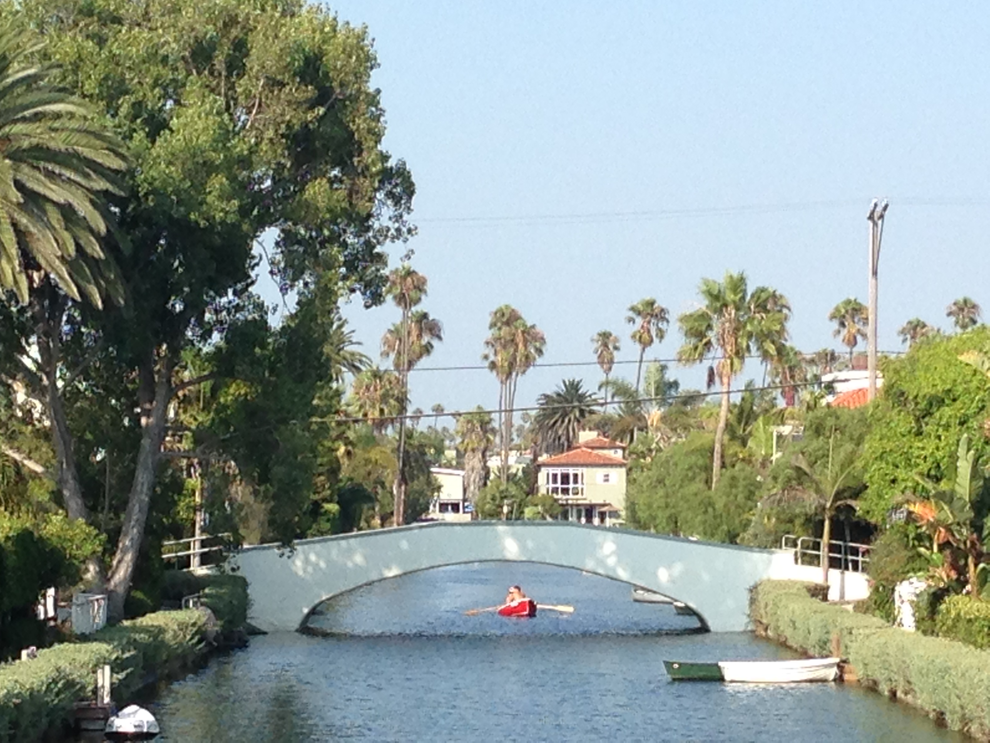
Back near the car we turn inland towards the picturesque enclave of the Venice canals.

IMG_0881

Orlando is interested in seeing where the characters from Californication live, but I just want to see the houses and imagine what it would be like to live in a place where I could moor a boat outside my front door. It’s a beautiful, peaceful setting, or it would be if there weren’t hundreds of tourists walking along every footpath and over every bridge.

IMG_0894

I look enviously at the verandahs, gardens and balconies, making mental notes of things I like. I decide to give our own tiny back garden a makeover when I get home.

IMG_0895

The sun is far over the yardarm by now, so we head back to the beach for a drink.

IMG_0915

We score a couple of bar stools on the balcony of the Venice Whaler and watch the sun sink towards the horizon.

IMG_0926

Walking back to the car along the water’s edge, the evening colours are perfect and I take a thousand photos trying in vain to capture the beauty of the moment.

IMG_0948 IMG_0955

Back on the boardwalk the evening crowds are out, bikinis and boardshorts swapped for only slightly less casual attire. The bars are filling up and the palm trees are beautifully silhouetted against the darkening sky.

IMG_0995

We have a one-night stopover in LA planned for December. I might change our boring airport hotel booking and see if we can come back here for 24 hours instead. All life is here!

the best view of the Hollywood sign

Go to LA, and you know that one of the top ten things to do is get as close as you can to the Hollywood sign.

It’s not that easy to walk right up to it, and anyway the closer you get to a forty-five foot tall sign, the less you will really see of it.

The most famous and most accessible viewing point is probably the Griffith Observatory, but the sign is still a good distance from there and it’s easy to get closer if you have a car.

From Hollywood itself, a good moving vantage point (if you are not the driver) is to drive up North Beachwood Drive, a north-south residential street lined with tall palm trees, because the sign is pretty much right in front of you the whole way. It’s still tricky to get a good photo of it from a moving car, but it’s fun driving through the Hollywood homes with palm trees swaying and the sign always in view. Especially if you’ve hired a convertible.

IMG_1073One excellent vantage point is at the end of an anonymous cul de sac, outside somebody’s house on another quiet residential street. Punch 5825 Green Oak Drive into your car’s GPS and it will take you up a steep winding street that gets narrower and narrower until you reach the last home and a gated entrance. Stop and take a look north-west – there she is. If you’re lucky there won’t be anybody else there and you will be able to take lots of shots unencumbered by photobombers.

IMG_1082

IMG_1076

Another (likely busier) spot is at 3204 Canyon Lake Drive, which is a bit closer again. If you can get parking nearby you can also walk towards the sign, which is probably less than half a mile away at this point. That, of course, is illegal but I’m told it’s unlikely that you will get stopped. The 24/7 security guard is stationed elsewhere at the gated roadway to the sign, and not looking your way.

But the most fun place to view the sign is from – wait for it – the original Batman’s Cave.

IMG_1099

Type 3000 Canyon Drive into your car’s GPS, which weirdly will take you into a park where you can park your car and walk the ten minutes or so up to a set of caves. Follow the walkers – it looks steep but it’s not far. At the end of the walk you will find a couple of shallow caves and a small clearing, where somebody has set out lots of concentric rings made of small stones and rocks.

IMG_1101

These are the Bronson Caves, most famous (to people of a certain vintage) as the exit of the Bat Cave from the original TV series. Standing by the concentric stone circles you will have a pretty great view of the Hollywood sign, and lots of opportunities to take photos with nobody but you in them.

IMG_1112

The best thing about this vantage point is that it’s a really accessible remote-looking setting, so it’s been used in lots of TV shows and movies, from low budget to blockbuster. As well as Batman this natural setting has been used to film everybody from Zorro to the Lone Ranger, Wonder Woman to the Might Morphin Power Rangers. As a Star Trek fan I was delighted to find out that almost every Star Trek TV show (and at least one Star Trek movie) has a scene filmed at the Bat Cave. Where better to view the iconic Hollywood sign?

IMG_1085

take the long way home

It’s easy, when you live very far from places you love, to go back and see them through the same lens again and again. So it has been recently with Galway and Connemara. The Cois Fharraige road out of Galway towards Spiddal and beyond holds so many memories for us that it has become our default entry and exit route from the rest of the region.

Today, we start our slow journey home from the west coast, taking a road less travelled for us. Heading back from Leenane towards Clifden, we take a narrow left turn just before Kylemore Lough, towards Lough Inagh and Recess. This is the Inagh Valley or Glen Inagh, a wide sweep of staggering beauty nestled between the Maamturk Mountains to the west and the Twelve Bens to the east.

IMG_0239

The Wild Atlantic Way signposts do not direct tourists this way, and we encounter only a few other souls on the ten-mile stretch. The weather is blisteringly hot and unusually calm for a late summer’s day in the west: as we move further from the coast we watch the car’s temperature gauge rise from 20C to 26C.

IMG_0257

Neither of these mountain ranges are high. The highest point in the Maamturks barely scrapes above 700 metres, whilst Benbaun in the Twelve Bens reaches 729 metres. By contrast, the highest mountain in Ireland, Carrauntoohil in County Kerry, reaches 1,038 metres. But the wide sweep of the valley, the dappled sunshine, the vivid greens making way for silver-grey quartzite rock, make this one of the most beautiful vistas in Ireland.

Lough Inagh itself is a great fishing spot along with nearby Derryclare Lough. Fishing enthusiasts come from all over the world to fish these waters for spring salmon, grilse, sea trout and large indigenous brown trout. We stop at the gates of Lough Inagh Lodge and take in the view.

IMG_0266

Turning left and eastwards at Recess, we drive to Maam Cross then north to the little town of Maam. We’re in different country already. The higher mountains have given way to lower hills and a little more vegetation. The short road from Maam Cross to Maam is again spectacular, and we pull over to the side of the road more than once just to take it in.

IMG_0276

IMG_0281

Down in the village of Maam, we are surrounded at all sides by the Maamturk Mountains. Keane’s pub has a blackboard outside offering soup and sandwiches. It seems the right place to stop for a pot of tea. Mum finds us a seat outside and I navigate the dark interior to place our order. “What sandwiches do you have?” I ask. “Well,” says my man, “we have ham, and cheese, and tomato, or any combination of the three.” Right so. Two pots of tea, two ham and cheese toasted sandwiches, two packets of Tayto. We’re all set.

IMG_0295

Last time Mum was here she said she thought this was what heaven looks like. Sitting in the summer sunshine with the beauty of Connemara all around, I’m inclined to agree.

IMG_0300

An Englishman sits beside us with his little blind dog called Shaddy and a half-finished pint of Guinness. He points to a white bungalow with a black tiled roof a couple of miles away. “That’s our house. My wife comes from round here, and we spend a couple of months here every summer.” God’s own country, indeed.

IMG_0302

Refreshed and ready for the off, we have another choice to make. Back to our “normally, usually” route, or find another road home? The Englishman recommends a route around the eastern shore of Lough Corrib, the westernmost edge of which is just down the road. I have not travelled that road for decades.

We set off in the evening sunshine and almost immediately come across a sequence of beautiful views across Lough Corrib, each one offering up a little more of the second biggest lake in Ireland.

IMG_0308

We stop briefly in Cornamona and wish we had packed some food to take advantage of a lovely little picnic ground right on the shores of the lake.

IMG_0317

A little further away from the lake shore, the picturesque village of Cong is decked out with more street flowers than seem possible. We don’t have time to stop and enjoy the waterways connecting Lough Corrib to nearby Lough Mask, or the riverside pubs and footpaths: the shadows are lengthening and we are a long way from Dublin. Nonetheless we can’t help ourselves one more detour towards the similarly pretty village of Clonbur and onwards to the Mayo border. We sit on the shores of Lough Mask, wishing we had one or two more days to explore this beautiful region.

IMG_0327

IMG_0326

The road from Cong through Headford to Galway city takes us a little further from the shores of the Corrib, but we catch glimpses of the dark water in the evening sun. Our next trip to Galway will likely include a few days in this neck of the woods, still technically Connemara but a gentler landscape somehow.

Now and again it’s good to take the road less travelled, to remind yourself what else of beauty is right around the next corner.

Supertramp: Take The Long Way Home